Sunday, October 9, 2016

Carbide Willson Ruins Hike - Old Chelsea, Gatineau

It's been a while since I last posted about a hike trail because I've been more dedicated to cycling the past year! I did, however, get a chance to visit the Carbide Willson ruins in Gatineau Park!

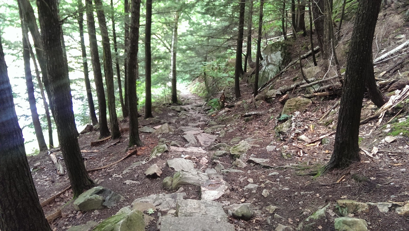
It's a pretty simple trail with a slight incline at times and will probably take you around 1.5-1.75 hours to complete, there and back, and that is including the time taken to hang out and take some pictures (unless of course you want to stay longer to enjoy the scenery!)

I've been wanting to check out this place for a while but never dedicated the time to it. It was quite busy when I decided to go but that was probably because it was Thanksgiving weekend. I would recommend checking this trail out as there are definitely some great photo ops here! Here are some pics. Hope you enjoy!


Tuesday, September 9, 2014

Difficult Hike Trails in Gatineau Park

1. Lusk Cave 

This trail is approximately a 50-55 minute drive (just as long as you don't get lost). Unfortunately, I got slightly lost driving there. Despite some shortcomings, the overall drive was not too bad to get there. 

To top it off, the signs leading to the trail were kind of misleading. It took about 25 minutes to get onto the correct trail that lead to the caves. If you go on the NCC website, you can download a pdf file of the map and description of the trail. 

Once on the correct trail, it was a pleasant and easy walk leading to the actual caves. The easy part of the trail was estimated at maybe 1.5-2 hours long one way, so 4h in total. The trail that we took (as there are at least two) was the one that followed the lake, so we passed a few beaches. 

Coming closer to the caves, there was board walk at times. There were also many rocks and the steepness became more evident, and so did the level of difficulty. This steepness was quite tolerable, actually. 

The actual caves themselves were pretty much a hidden treasure. I would highly recommend checking out these caves if you have at least a whole day off. 

We departed around 10am from downtown Ottawa and arrived at the Parent parking lot around 1130. The entire hike itself took around 4.5-5 hours to complete, additional time due to the fact we got lost a few times and took many photos. Also, I definitely got stuck in a thunderstorm on my way back to the parking lot but I had my umbrella and raincoat handy! It's definitely handy to throw in all your much needed hiking equipment/materials in case of rapid weather changes. 

This effort was definitely worth it though and I would recommend other hikers to try this trail out at some point in the near future.

PS. It would be wise to bring swim wear, change of clothes, a towel and also a head lamp if you're planning on going through the caves. There is water present in the caves that apparently can be as high as a metre, all depending on the time you visit and season. The caves also become very dark at the middle section. No headlamp is very dangerous. Bringing small snacks is also a great idea since this hike is quite long and we found that we became quite hungry after we were done exploring the caves. 

Finally on the right trail,
peering to the left is this waterfront view

Pleasant and easy trail 

One of the beaches that we pass through

Getting closer to the caves 

Finally arrived at the caves 

First section/entrance of caves

Second entrance of caves

Taking a quick break before entering the caves

Entered the cave, looking out

Looking into the caves,
left my headlamp behind (unfortunately)
A view from the top
(Walking through 2nd entrance of cave)

2. Luskville Falls

The drive from downtown Ottawa takes approximately 45 minutes. Luckily my GPS on my cellular was quite functional and I did not get lost. The drive to this area is quite enjoyable, characterized by winding roads through forests and farmlands, as well as suburban areas in cottage like settings/townships. I did not need to print a map out of this trail as it was pretty easy to figure out, there was usually just one obvious trail leading up and down. 

This trail was actually very challenging, especially for my semi-recovered bilateral knee sprains. The challenge is in due part to the steepness of the trail. I could definitely feel the irritation in my hamstrings after  3 hours, especially downhill. 

The views are definitely worth the long hike, as there are many great photo opportunities as displayed by my photos below. Surprisingly enough, there is data/ internet access available on this trail, even up at the top 300m elevation. 

First part of the waterfalls

Action shot at second part of falls


Investigating the trickle of water from the waterfall

Slowly making our way to the top

Some rocks where we could get a nice view

Another view of the waterfall
(third part of waterfall)
Striking a yoga pose

Crossing over some logs, trying to make it to the fire tower

Realizing it's getting dark,
we turned around and enjoyed the sunset


Sunday, August 17, 2014

Hike Trails in Ottawa & Gatineau Area: King Mountain, Lime Kiln, Petrie Islands, & Waterfall Trail


1. King Mountain Trail

After another session of physiotherapy, I had decided to check out the long anticipated King Mountain Trail. My physiotherapist and I had determined that the sprains in my knees have been healing presumably well. I also purchased trekking poles to help, as I had read online that they can take off about 40% of the weight on your knees when trekking-- this, I can definitely vouch for. 

The trail takes about an hour to complete. If you stop to take photos and enjoy the scenery, it most likely will take about 1.5 hours. There are a lot of lookout spots here, so I suggest taking your time to check each one out. Also, climbing of the rocks are necessary to get a great view in some areas. Having a friend nearby helps, especially if you need a helping hand when climbing! 


There is a split pathway before the pond. The pathway to the right is the one with stones and much easier to climb than the left. The left contains many wooden stairs and is quite steep at times. I recommend taking the pathway to the right since it is a gradual but steady increase. I tried to use my trekking poles here but it was actually awkward and more difficult for me than without them. The rest of the path, the trekking poles were very useful. 


The pond right at the start of the trail
My physiotherapist at the top,
giving me encouragement!
Looking downwards 
There are tons of rocks, so be careful,
especially after a rainfall

First great view

Me, at the top :)

Second great view

Looking over the edge
King mountain trail was definitely an enjoyable trail. I would probably do this hike again in the near future. It is probably more breathtaking in the fall because of all the nice colours. 

This Gatineau Park trail is one of the more challenging trails. Due to the presence of numerous rocks, I would not recommend running here since it's very easy to trip over the edge of a rock. The path is not smooth or even, especially when going upwards. 


Going back down, the trail is much easier because there is a built staircase. There are also some structures along the trail, and the signs are worth a good read. 


Remember to always take a moment to breathe. This trail definitely has some elevation to it. This trail may not be very high in terms of elevation, however, for future notice, the higher the elevation, the more important it is to take a breath with each step. In hikes on mountains that are much higher, altitude sickness can occur and is very serious. This will be covered more in depth in another section where higher elevation is more of a concern, however, if you are curious, you can check into altitude sickness here: http://en.wikipedia.org/wiki/Altitude_sickness


Check out King Mountain Trail in Gatineau Park if you're looking for a moderate-challenging hike that takes around 1-1.5 hours to complete and has great views! 


2. Lime Kiln Trail  
(Stony Swamp/ Greenbelt -P10)

Honestly, I really love this stony swamp area that the NCC has worked on. I really want to congratulate these people for preserving our wetlands and developing these wonderful trails outdoors. I find this area very authentic, and I've probably visited the trails in these areas more often, or maybe just as much as I visit Gatineau Park trails. These trails don't have much elevation as compared to Gatineau Park, actually, they're relatively flat. The animal interaction here is incredible though, and something quite special. So here, in the lime kiln trail are exactly that: remnants or ruins of an old lime producing oven. In earlier days, this structure was where lime was produced by heating limestone. Lime was used as a binding product for building blocks, such as stones or bricks, etc. It was also used as a stabilizing product in floors. 

Second structure of Lime Kiln 
(essentially an oven)
Looking into the kiln
Looking down from the top
Top of Kiln


Continuous trail after the kiln
Plants that are taller than me along the trail

So it was raining and my friend and I decided to continue walking for a bit. This trail wasn't as exciting as the kiln but it was a nice distance nonetheless. After reaching the main road finally, we decided to return back to lime kiln. As if that wasn't exciting enough, the weather started to ease up a bit and the rain stopped.

The real magic in this trail is the interaction of the birds. I had purchased a book of Ontario birds in Coles and wanted to see and study which birds would interact with us. Due to the light rain, although we could hear the birds, they still refused to interact. Once the rain stopped, the birds came out and their chirps became louder. 

My friend correctly identified them as chickadees. I used a whistle and seeds to entice them and pique their curiosity. Though the chickadees were the only birds to approach and interact, it was still tons of fun. Unfortunately, The birds were totally uninterested in the seeds.My friend had to be ready with the camera to take these pictures because the birds were quick to become frightened and fly away. 

It was a great experience overall :)
Chickadee in the tree


Close-up shot of the first chickadee


Second chickadee close-up

Lime Kiln Trail is definitely a great quick hike worth checking out in the Stony Swamp area. 

3. Petrie Islands

Petrie Islands is located in East Ottawa. Basically you head east on the 174, direction to Trim Rd. Turn left on Trim Rd. and continue for about 5 minutes and you will reach Petrie Islands. Keep driving to the very back, where you will eventually see parking lots. The trails are along the left side and the beach to your right. The parking is $2.00 for 5 hours. 


It's definitely an area that has more activity with people of all ages visiting. This is definitely a more commercialized wetland conservation area which is family oriented. The trails are quite short, where the longest is maybe about 30 minutes long. There are quite a few people fishing as well. This hike spot is definitely a flat area, but worth checking out if you haven't done so already. Plus there is a beach, so that option is great if you enjoy sunbathing and swimming. Check the online e.coli levels to see if it is safe to swim in these waters before visiting so that you are not surprised if it is closed to swimmers. Be mindful that e.coli levels are always higher after a rainfall.  


Here are some pictures along the trails of Petrie Islands:


For a nice family oriented hike area with short and fairly easy trails, Petrie Islands is a nice place to visit. Some great pictures can be taken here as well. 

4. Waterfall Trail
This trail is located in Gatineau Park. I really wanted to do this trail because last time I couldn't reach the waterfall due to the how steep it was (I was in the acute stages of my sprained knees). Apparently, the flow was very weak 3 weeks ago. I was extremely happy when I got to the waterfall. It was a great place to just meditate for a bit. I tried checking out the 1.3 km Lauriault trail to see if there was anything interesting but it just lead to a parking lot. 
Taking a quick moment to enjoy the nature

Second bridge on the pathway to the waterfalls

Lookout at the waterfalls (looking down)

Steps leading to the waterfall (upwards view)
Me at the base of the waterfall

It's a relatively quick hike from Mackenzie King estate. Max 30 minutes. If you want to skip the estate, just continue driving straight past the entrance to the estate and park at the next stop which is the Waterfall trail lot. Go to the left side of the parking lot and use that entrance to quickly arrive at the waterfall. The other entrance to the right and front of the lot will lead back to Mackenzie King estate. I only realized this afterwards.

Check out the waterfall trail when you get a chance! It's a great place to hang out and enjoy nature and the sounds of water flowing.